In 2003, ten years after the first registered homicides o...

One of the 32 states that form the Republic of Mexico Chihuahua is located at the northern part of the country and shares its borders with the states of New Mexico and Texas in the U.S., to the north and with the Mexican states of Coahuila and Durango to the East Durango and Sinaloa to the south and Sinaloa and Sonora to the west.
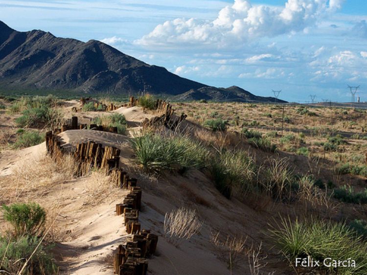
Its territory extends throughout 247,455 sq. kilometers which represent 12.6% of the nations surface. Within this vastness it contains great diversity of ecosystems and micro-climates which include the beautiful Tarahumara Sierra the Samalayuca Desert and wonderful plains that form what is known as the Mesa Central or central plateau.
The mountain range of the western Sierra Madre on the west of the state is conformed by great plains cliffs canyons and sierras. While its plains are covered with fresh forests of pine oak and cedar its mountains give birth to numerous rivers such as the Papigochi Conchos Mayo and El Fuerte home to abundant trout catfish, carp and otter and also offer spectacular canyons and cliffs with depths of up to 1,870 meters that contain tropical green vegetation at the bottom in high contrast with the rest of the landscape found in Chihuahua.
The central part of the state home to large pasturelands that support much of the livestock and agricultural fields in the region presents a dry and extreme climate, hot during day time and cold at night.
On the other hand the deserts of Bolson del Mapimi in the south and Chihuahua in the north and which form the eastern band of the state report a climate that qualifies as arid reaching whopping 44oC in the summer and less than 250mm of rainfall for a whole year. This inhospitable environment is home to plants such as catkin, cassie or huisache, prickly pear and all kinds of cactus; and to fauna such as rabbit, hare and snakes.
The main state elevations above 2,500 meters of altitude include the Cerros Mohinora and San Jose; and the Gasachi , San Luis and La Escondida Sierras.

In 2003, ten years after the first registered homicides o...

One of the best known products that Mexico has given to t...

In 2003, ten years after the first registered homicides o...

Since ancient times, man has dreamed of flying. The first...

This island, born from volcanic activity, with a vast are...

The last administrations of Mexico Cityâs Government ha...
.jpg)
Its full name is Dolores Hidalgo, Birthplace of National ...